
The lava flows from the long extinct Mt Warning Shield volcano formed the headlands of the Gold Coast coastal strip including the rock formations of North and South Nobbies.
In Yugambeh Dreamtime stories, Jabreen, a giant carrying a fighting club, formed the imposing headlands at what became known as Burleigh Heads and Little Burleigh at Miami.
However, there is no definitive answer as to why European settlers named the two headlands at Miami ‘The Nobbys’. There is also uncertainty as to whether it is known as Nobby, Nobbys or Nobbies. Official maps and the Queensland Place Names Board refer to the area as Nobby, though locally the term Nobbies is also used.
-
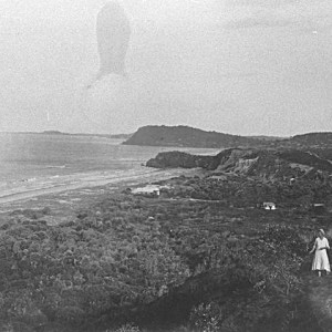
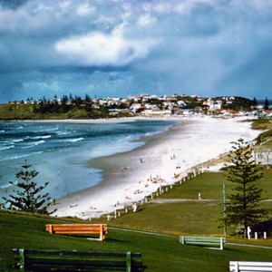
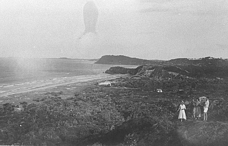
- Looking south from North Nobby to Burleigh Heads, circa 1930. Photographer unknown
-
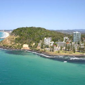
- Looking towards the headland, Burleigh Heads, 2005. Photographer Graham Weeks
-
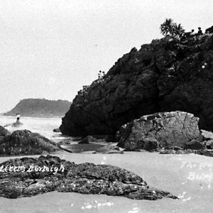
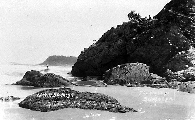
- Rocks and headland at Little Burleigh, circa 1920s. Photographer unknown
In 1989 it was suggested that the landforms, when seen from the sea, resembled knees and perhaps this had resulted in Captain James Cook or Patrick Logan naming the rocky outcrops in their initial surveys. This has not been proven and there is no clear reference to the rock formation in Sir Joseph Bank’s Endeavour Journal or Captain Cook’s Journal.
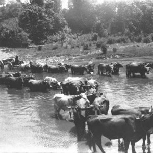
Another theory, and this recorded by travellers through the district, is that the name originated with Frederick Fowler. Frederick Fowler was one of the first new arrivals to settle at Burleigh and used bullock teams to haul timber cut from Tallebudgera down to Ned Harper’s wharf on the Nerang River near present day Wharf Street, Surfers Paradise. The bullocks were allowed to graze around the two hills (North and South) and when needing to herd his team, Fowler would call the name of the lead bullock whose name was Nobby.
In the early 1960s, North Nobby was home to a kiosk and chairlift which offered visitors panoramic views of the surrounding area. In 1975 the site on top of the headland was turned into the Magic Mountain theme park which operated until 1987.
For many years the fishing reports in the local newspaper referred to the different varieties of fish caught off the headlands and local fishermen used the turrets of the castle as a beacon to locate prime fishing spots until the castle was demolished in 1994. Painted bright orange, the turrets were also a navigational aid.
Sources of information and further reading
- “Preferred, but S not essential in Nobbys.” Gold Coast Bulletin, (Southport, Qld.) 4 Nov 1989.
- Gold Coast Bulletin, (Southport, Qld.) 14 Nov 1994.
- Green, Sandra. Nobbys and the Johnstons. Sydney: Sandra Green, 2014.
- Longhurst, Robert. Nerang Shire: a history to 1949. Nerang, Albert Shire Council, 1994.
- Willmott, Warwick, et al. Rock and landscapes of the Gold Coast Hinterland. 3rd Ed. [Brisbane]: Geological Society of Australia, Queensland Division, 2010.
- http://www2.sl.nsw.gov.au/banks/series_03/03_629.cfm Accessed 5/1/2016.
- http://southseas.nla.gov.au/journals/cook/17700516.html Accessed 5/1/2016.
- http://www.goldcoast.qld.gov.au/documents/bf/fs-our-coastal-zone.pdf Accessed 4/1/2019.